08.08.14, 15:24
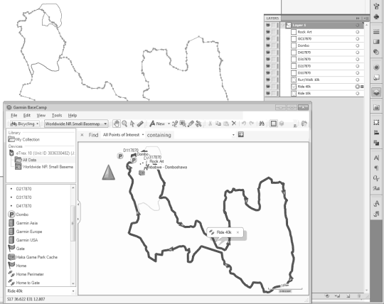
This script creates Illustrator paths and points from a .csv file exported from Garmin’s free BaseCamp software.
In BaseCamp, select any number of tracks and/or waypoints and go to File > Export > Export Selection. Select .csv as the file type and save a copy of this file in the same location as the script.
You’ll need to open the script and change the file name of the .csv file near the top, or save your .csv as “GPS Route.csv”.
You can run the script in a document of any dimensions. The tracks and points will be scaled to fit proportionally into the artboard bounds within a margin set in the script. The script will use the active style, so the points may be invisible until you apply some formatting to them. All tracks and points will be correctly labelled in the layers panel, so you can target them easily this way.
The waypoint objects created in the script have a “Symbol” property which is not used, but you could easily modify the script to take advantage of this (eg applying a style or using an appropriate symbol from the library).
I’d appreciate any feedback, and would love to hear if you find the script useful. If you have any trouble with it, I’d be happy to try to help out.